 FreeWill Labs
 Explore on the web · Journal on iPhone
PaddlePin
Web + iPhoneFind your next paddle. Know if it’s right for you.
PaddlePin is a paddling discovery platform. Browse paddleboard and kayak spots on PaddlePin.com — where to put in, what the carry is like, how hard the route is, and what to watch for — then record and remember the paddle with the PaddlePin iPhone app.
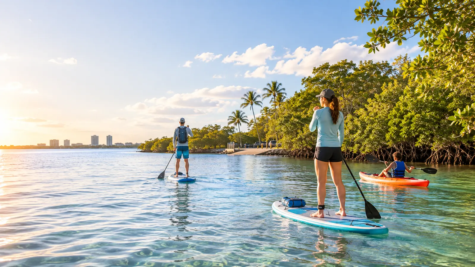
Finding water on a map isn’t the same as finding a good paddle.
Launches, parking, how far you’ll carry the board, whether it’s beginner-friendly, what wind and tide do to the route — the answers are scattered or missing.
PaddlePin researches them, says plainly what’s still unknown, and gets better every time a paddler checks a spot in the real world.
How PaddlePin fits together
Discover, decide, paddle, remember.
A web directory to find the spot, location intelligence to judge it, an iPhone app to keep the paddle, and partners who help keep it all accurate.
Discover · PaddlePin.com
Find where to paddle
Browse paddling locations by region. Each one has its own page with launches, routes, and what to expect.
Explore locations →Decide · Location intelligence
Know what you’re getting into
Carry distance, launch type, route difficulty, hazards, conditions to watch, and local context — with an honest confidence level on every fact.
See a location page →Remember · iPhone app
Keep the paddle
Record your route, drop pins, take photos, and build a journal of every place you’ve paddled.
Get the iPhone app →Partners · On the water
Local knowledge, kept current
Outfitters, parks, and paddling organizations help keep locations accurate — and get found by the paddlers looking for them.
PaddlePin partners →The iPhone app
Record the paddle. Keep the memory.
Quick start, GPS route, pins and photos, and a paddle journal — built to work on real paddles, including chaotic family outings.
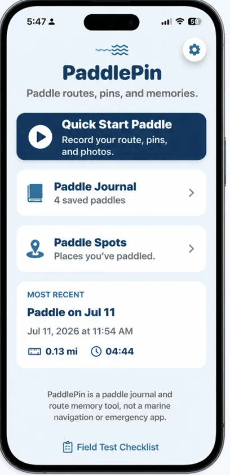
Quick start
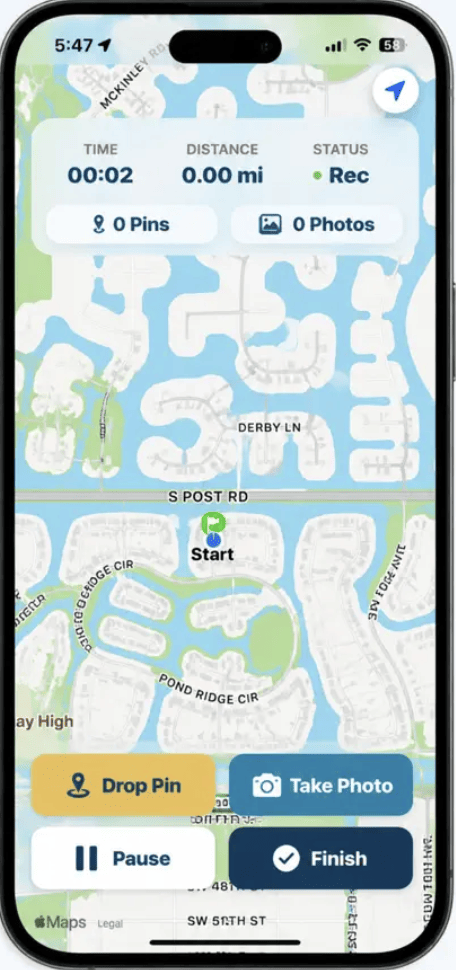
GPS route, pins, and photos
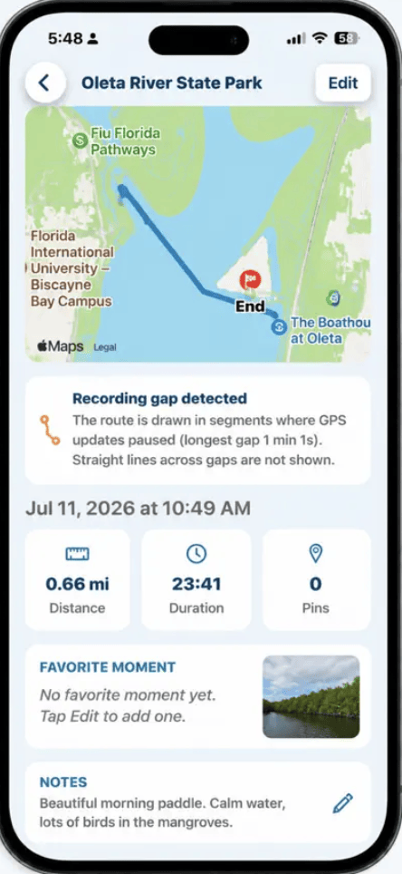
Paddle journal
Made for
Everyone deciding where to paddle next.
Where to paddle
Beginner paddle guides for South Florida.
Looking for a specific spot? Browse the full directory on PaddlePin.com →
Paddling the Florida Keys With Kids: SUP or Kayak?
John Pennekamp, Curry Hammock and Bahia Honda — launches, conditions, and choosing between board and boat.
Read the guide →Beginner Paddleboarding in Fort Lauderdale: 5 Calm-Water Spots
Quiet canals to a state-park creek — the calm-water spots worth starting on, with kids on board.
Read the guide →Beginner Paddleboarding in Miami: 6 Calm-Water Spots
From the Oleta mangroves to Biscayne Bay — easy, beginner-friendly places for a first paddle.
Read the guide →From FreeWill Notes
Field notes from the water.
Testing PaddlePin at Oleta: What Makes a Paddle Worth Remembering
Early field notes from testing PaddlePin on the water at Oleta River State Park.
Read the note →Mapping the Route Is Only Half the Story
PaddlePin is being designed around the full paddle experience: route, workout, and the moments worth remembering.
Read the note →FAQ
Common questions
What is PaddlePin?
Do I need the app to use PaddlePin?
Where does the location information come from?
Where is PaddlePin available?
How do I get the app?
Is PaddlePin part of FreeWill Labs?
Ready for your next paddle?
Find a spot, check what you’re getting into, and go.